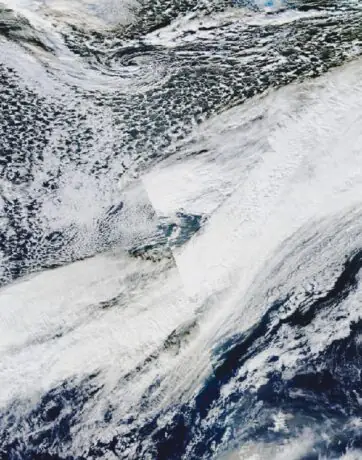
The World Meteorological Organization has warned that El Niño could reach exceptional strength late in 2026, urging humanitarian preparations before its peak. The forecast raises regional flood and drought concerns, while leaving the timing and severity of individual weather events uncertain.
A new warning from the World Meteorological Organization has sharpened the question facing governments and aid agencies: how much protection can be put in place before a major climate disturbance reaches its strongest phase? In its October 21 statement, the WMO projected tropical Pacific sea-surface temperatures potentially reaching 3.8°C above average during November 2026–January 2027, with the event peaking around December. That is a forecast of a regional ocean anomaly, rather than an announcement that the whole planet has warmed by that amount. WMO statement.
The distinction matters because the most arresting number in a climate headline is often the easiest to misread. A regional forecast, a global temperature measurement and a prediction for tomorrow’s rainfall answer different questions. For communities exposed to flooding or crop losses, the practical value of this announcement lies in the decisions it can inform before local hazards become emergencies.
What has changed in the latest warning
WMO Secretary-General Celeste Saulo presented the outlook alongside UN humanitarian chief Tom Fletcher. The organisation highlighted wetter conditions in parts of East Africa, drier conditions threatening southern African agriculture, and heat, rainfall deficits and fire risks in Southeast Asia. It stressed that national and regional forecasts remain essential: a seasonal outlook does not identify the date or location of a particular storm. October 21 briefing.
The United Nations’ account of the joint appeal places the issue in a humanitarian setting, calling for immediate help for vulnerable communities. That emphasis shifts the discussion from a competition over climate records towards exposure: which people have reliable shelter, water, transport and assistance if conditions deteriorate? A severe climate signal can produce very different consequences in places with different resources. UN account of the appeal.
The ocean and atmosphere act together
El Niño belongs to the El Niño–Southern Oscillation, a recurring interaction between the tropical Pacific and the atmosphere. NOAA’s explanation describes warmer surface water in the central and east-central equatorial Pacific and weakened easterly trade winds. Changes in where warm water and tropical rainfall are concentrated alter the wider circulation. This is why an ocean pattern can influence weather far beyond the coastline nearest to it. NOAA ENSO questions and answers.
Thinking of that connection as an influence on the distribution of weather is more useful than imagining a single giant storm moving around the globe. El Niño is a background condition affecting the odds under which many weather systems develop. Those systems still interact with geography, other circulation patterns and the conditions already present on the ground.
NOAA’s broader FAQ also distinguishes this natural redistribution of heat from changes to the climate system’s overall energy balance. El Niño and human-driven warming should therefore not be treated as interchangeable terms. They can affect the same season without being the same process. A clear explanation needs to preserve both the short-term variability and the longer-term context. NOAA climate explanation.
Earlier monitoring already showed a strengthening event
The US Climate Prediction Center’s October 8 discussion provides an independently issued operational checkpoint. It described a strengthening, coupled ocean–atmosphere El Niño and assessed a strong-to-very-strong event as likely through January–March 2027. It also reported different values for different Niño monitoring regions, including +2.1°C for Niño-3.4 and +3.0°C for Niño-3 in the preceding month. Those observations should not be substituted for the WMO’s later seasonal projection. NOAA October 8 diagnostic discussion.
Different monitoring regions, reference periods and forecast windows can produce different numbers without one automatically disproving another. An observation describes conditions that have already been measured; a projection describes a possible future state. Comparing them responsibly requires matching the geography and the averaging period first. Otherwise, an apparently dramatic change may partly be a change in what is being compared.
The same NOAA discussion cautions that even a large event does not guarantee its familiar regional impacts. That caveat does not empty the outlook of meaning. It explains why probabilities are useful for planning and insufficient for declaring that a specific city will flood on a particular day.
Why early assistance is different from disaster relief
The current appeal builds on preparations already under way. In June, the Food and Agriculture Organization and World Food Programme issued a joint anticipatory-action appeal covering June 2026–March 2027. Its stated aim was to protect nearly nine million people across 22 countries against potential effects of a strong El Niño. That was a funding and operational objective, not a report that all those people had already received assistance. FAO–WFP appeal.
FAO’s accompanying explanation describes support tailored to local circumstances rather than one standard intervention applied everywhere. That is an important operational distinction. Preparing for a rain deficit involves different choices from preparing for river flooding, even when the same large-scale climate pattern contributes to both risks. FAO’s June explanation.
For illustration, a preparedness team facing possible road disruption might review where supplies are stored, while an agricultural team facing rainfall deficits might review how assistance aligns with planting decisions. These are examples of the decisions forecasts can support, not claims that either action has been ordered everywhere covered by the warning. The common requirement is enough lead time to act.
The difficult decision: acting before certainty
Anticipatory action links forecasts with decisions made before the worst effects arrive. The Red Cross Red Crescent Climate Centre describes forecast-based financing and support for National Societies to take early action. The purpose is to make the relationship between a warning, a planned response and available resources explicit. Climate Centre overview.
There is a genuine judgement involved. Waiting for damage to become visible can make assistance slower and more expensive to organise. Acting too broadly on a poorly matched forecast can use scarce resources where they are less needed. The solution is not to demand impossible certainty, but to choose actions whose cost, timing and reversibility fit the confidence and potential consequences of the forecast.
An OCHA-supported discussion of lessons from anticipatory-action pilots identifies three connected components: triggers, programming and financing. A technically impressive forecast is only one part of that chain. Someone must know what threshold changes the decision, what response follows, and how the response will be funded. Lessons from anticipatory-action pilots.
How to read the maps and warnings that follow
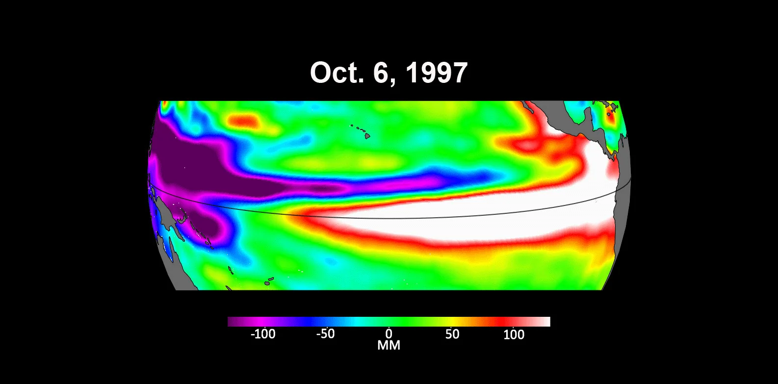
Historical satellite maps help show why dates and measurement labels matter. NASA’s October 2023 comparison of earlier El Niño events used sea-surface height anomalies from 1997, 2015 and 2023. Warmer water expands, so height measurements can provide information about ocean conditions. They are nevertheless measurements of height, with their own units, rather than interchangeable temperature maps. The archive image accompanying this article depicts October 1997 and is not a picture of the 2026 forecast. NASA’s historical comparison.
The same reading discipline applies to a shared screenshot of a forecast. Check when it was issued, which months it covers, whether the colours represent probability or an amount, and what geographical area the underlying number describes. A coloured patch on a global outlook cannot replace a flood warning, river measurement or short-range forecast issued for a local area.
Turning a broad warning into an accountable response
One way to assess the next phase is to ask what has changed locally because of the forecast. An authority may publish a preparedness plan, identify a responsible agency or explain when a warning will trigger additional action. These are different from merely repeating the international headline. A plan becomes easier to evaluate when its timing and responsibilities are public.
For example, a hypothetical district considering flood preparation would need to connect seasonal information with its own drainage, river and transport conditions. The international outlook might justify earlier review; it could not specify which road should close on a particular afternoon. That decision requires much more immediate and local evidence. Explaining the division of responsibility helps people understand which source to consult as the season progresses.
It also creates a fairer basis for judging a forecast. A probability shift is not invalidated whenever one location experiences an ordinary day. Nor does one extreme event prove that every detail of a seasonal assessment was correct. Evaluation should compare the stated area, period and variable with what was actually observed, rather than retrospectively selecting the most dramatic example.
For aid agencies and donors, the corresponding question concerns implementation. An appeal can identify needs without closing a funding gap. A commitment can be announced before resources reach an operational team. Tracking those stages separately allows attention to remain on whether communities gain useful protection, rather than on whether the announcement itself attracted enough attention.
What to watch next
The useful next developments are updated seasonal assessments, national warnings and concrete preparedness announcements. Claims about funding should distinguish money requested from money committed or delivered. Claims about impacts should distinguish forecast exposure from confirmed losses. Those distinctions make it possible to assess whether the response is keeping pace with the evolving risk.
Climate reporting also covers processes operating over very different timescales. Our report on the revised Thwaites Glacier outlook concerns long-term ice and sea-level research; the present warning concerns seasonal ocean–atmosphere conditions and near-term preparation. Both require careful treatment of uncertainty, but their numbers answer different questions.
As of October 22, the central verified development is a stronger warning and an urgent call to prepare. The exact local consequences remain dependent on the weather that develops and the conditions communities face when it arrives. The test of the warning’s value will be whether useful protection reaches those communities while there is still time to make a difference.
Smashology Editorial Team
The Smashology Editorial Team is responsible for reviewing and publishing content at Smashology Media, overseeing sourcing, fact-checking, corrections, and editorial standards across coverage of internet culture, technology, entertainment, news, and crime.
Sources
Links cited in this article.
- Original sourcenasa.gov
- reuse termsnasa.gov
- WMO statementwmo.int
- UN account of the appealun.org
- NOAA ENSO questions and answerscpc.ncep.noaa.gov
- NOAA climate explanationclimate.gov
- NOAA October 8 diagnostic discussioncpc.ncep.noaa.gov
- FAO–WFP appealwfp.org
- FAO’s June explanationfao.org
- Climate Centre overviewclimatecentre.org
- Lessons from anticipatory-action pilotsanticipation-hub.org