Storm Boelo has been named ahead of strong weekend winds across northern parts of the UK, while Storm Austen brings an earlier round of rain and gales. Official forecasts describe two separate systems, making warning locations and start times crucial for travel planning.
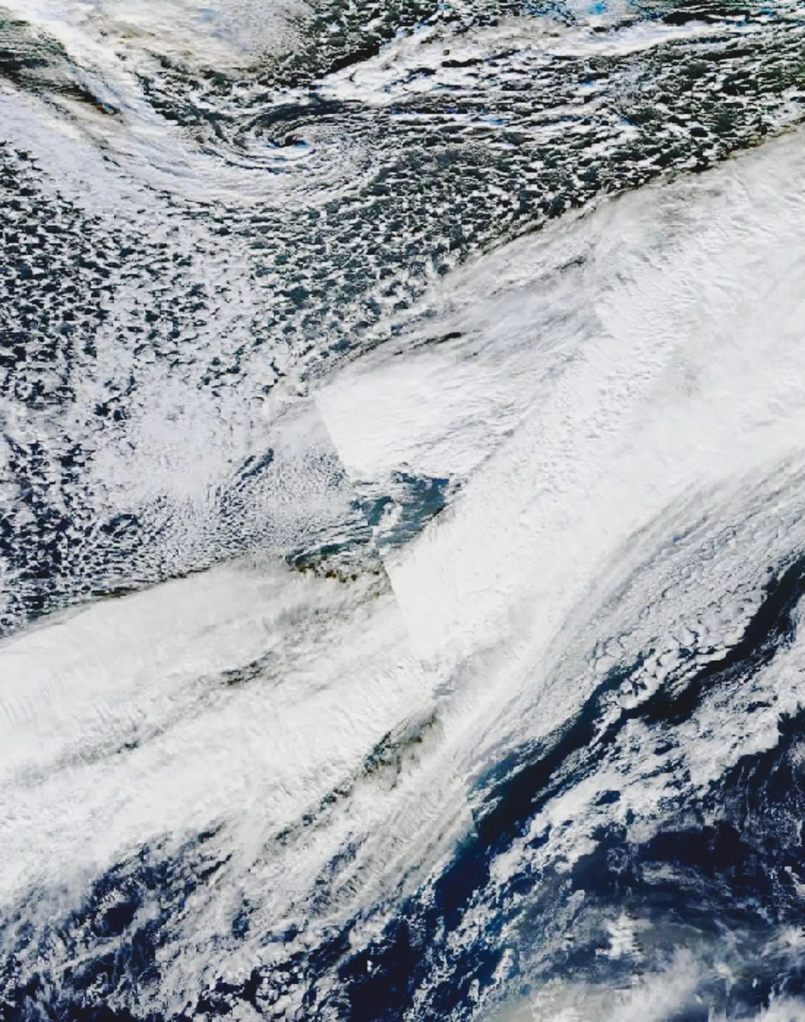
Storm Boelo is forecast to bring another period of disruptive weather to parts of the UK this weekend, following closely behind Storm Austen. The Met Office named Boelo on October 22, describing strong winds arriving in Northern Ireland and western Scotland on Saturday, October 24, before spreading through the night and into Sunday. This is a forecast of an approaching system, rather than a report that the weekend’s predicted gusts have already occurred.
The immediate message for readers checking the news early on October 23 is to keep the storms separate. Austen is the nearer-term concern; Boelo is the following system. A warning for Friday should not be used as the timetable for Saturday’s journey, and the weekend warning does not replace precautions needed during Austen. All warning times discussed here are local to the issuing UK or Irish service. The linked live pages should take precedence if forecasts change after publication.
Storm Boelo: where the weekend warnings apply
The Met Office’s October 22 announcement places a yellow wind warning over mainland Scotland, the Western Isles, Orkney and far northern England from 18:00 on Saturday to 21:00 on Sunday. Forecast gusts are widely 55–65mph, with 70–80mph possible at exposed coastal locations. A separate Northern Ireland warning runs from 18:00 Saturday to 15:00 Sunday, with widespread gusts of 50–60mph and exposed-location gusts of 65–75mph. These are forecast ranges within warning areas, not a promise that every address will experience the highest figure.
Independent weather coverage from YourWeather on October 22 also describes the succession of two systems and the threat of strong winds and heavy rain. The distinction between a general forecast and a local warning matters: a national headline cannot tell a reader whether a particular road, railway line or coastal path will be safe at a particular hour. Check the warning map alongside a local forecast rather than using the storm name alone.
Saturday’s rain and the strongest wind period do not necessarily coincide everywhere. That makes a single screenshot especially easy to misread. A person leaving home before the peak wind window may still be returning during it. A weekend plan therefore needs a return journey as well as an outward journey, with any decision about an exposed route made against the latest information for that route.
Austen comes first on Friday
The Met Office’s UK forecast, updated at 15:00 on October 22, describes Austen bringing overnight rain and strong winds, followed by further unsettled conditions on Friday. It identifies the possibility of damaging winds in Cornwall and western Devon overnight and severe gales in parts of the south and west. Those details belong to Austen’s passage, rather than to Boelo’s later northern warning areas.
That geographic change is easy to lose in rolling coverage. Two storms arriving close together do not have identical tracks or identical impacts. Someone in southwest England may be reading about an immediate wind threat while someone in northern Scotland is preparing for a later weekend window. The useful question is which official warning covers the reader’s location and time of travel, rather than which storm has generated the biggest headline.
Conditions can also remain awkward after the strongest gust has passed. A forecast becoming less windy does not establish that every fallen branch has been cleared or every transport service restored. Equally, this article does not claim that a specific line has closed, that an airport has cancelled flights or that casualties have occurred. Those would require separate confirmation from the relevant operator or authority.
Ireland’s alerts distinguish land from sea
Across Ireland, Met Éireann’s warning page checked on October 22 lists an orange rain warning for Cork, Kerry and Waterford associated with Austen, valid from 22:00 Thursday until 05:00 Friday. A yellow wind and rain warning for Leinster and Munster runs from 19:00 Thursday until 10:00 Friday. Readers following these alerts should pay attention to both the county list and the end time, since neither is interchangeable with the UK warning map.
The same service also publishes marine warnings. Its Austen storm-force warning covers specified coastal waters and part of the Irish Sea, with a Thursday-night-to-Friday-morning window. A marine warning describes conditions at sea; it should not be presented as an orange land warning for every nearby county. That distinction is especially important when a cropped social-media image removes the heading identifying the type of alert.
For the weekend, Met Éireann’s Sunday warnings page carries an orange marine storm warning associated with Boelo for waters from Erris Head to Bloody Foreland to Belfast Lough, valid from 18:00 Saturday until 10:00 Sunday. It forecasts storm-force 10 winds. Other marine gale and small-craft advisories cover broader waters and different periods. People using boats need the marine bulletin itself, including its named sea areas, rather than a simplified description intended for land travel.
What a named storm tells you
The UK Storm Centre explains the shared storm-naming work of the Met Office, Met Éireann and the Netherlands’ KNMI. Naming is intended to make communication clearer when a system could have significant impacts. It is not a separate universal scale comparable with a forecast wind reading, and the same named system can generate different hazards in different places.
The practical value of the name is continuity. When an official bulletin, transport operator and broadcaster discuss Boelo, readers can connect updates about the same developing system. The name becomes less useful if it is treated as a substitute for the bulletin’s detail. Dates, warning boundaries and confidence remain necessary, particularly when another named storm is already moving through the region.
In an October 2026 explanation of naming decisions, the Met Office addresses why a storm can be named while some warnings remain yellow. Naming can reflect expected impacts elsewhere in the partner region or a developing risk. A yellow label therefore does not contradict the existence of a named storm, nor does a name automatically mean that a red warning has been issued.
Read warning colours with the accompanying detail
The Met Office’s warnings guide says warning colours reflect a combination of the likelihood of impacts and their possible severity. Yellow, amber and red are therefore risk communications, rather than simple labels attached to one nationwide wind-speed threshold. The written explanation and the location of the warning on its impact matrix help explain what forecasters expect.
A useful reading order is location, valid period, expected impacts, then the detailed forecast. This prevents several common mistakes: treating the maximum exposed-coast gust as a city-centre forecast, carrying a warning forward after its validity ends, or assuming that the absence of a higher colour guarantees no disruption. The official page also allows readers to see whether an update has changed the boundary or timing since an earlier report.
Local reporting can add useful detail without replacing that official source. Shannonside’s October 22 report, for example, distinguishes the approaching Boelo system from county-level changes to Austen warnings. It illustrates why an alert discussed in yesterday’s coverage may no longer apply to exactly the same set of places. A changed warning is new information to act on, rather than evidence that all earlier forecasts should be ignored.
Practical preparations before the strongest winds
The Met Office’s storm-safety guidance advises securing loose outdoor items before bad weather arrives and staying away from dangerous coastal conditions. Bins, garden furniture and other unsecured objects can become hazards. The same guidance cautions against attempting repairs during an active storm and recommends assessing damage only when it is safe to do so. Preparation should happen ahead of the strongest conditions, rather than becoming an extra reason to go outside during them.
For a household or small business, the sensible planning exercise is specific: identify what can be secured safely in advance, how to receive updated warnings, and which activities can be moved if local conditions worsen. A weather article cannot assess a particular roof, tree or building. It can point readers toward the official forecast and encourage decisions early enough that they are not forced to improvise during the warning period.
Transport information needs the same discipline. Check the operator for the service actually being used, including any later connection. Do not assume a national weather warning is itself a cancellation notice. Conversely, a service showing as scheduled hours beforehand does not guarantee that it will operate unchanged if conditions deteriorate. Keep the distinction between the forecast risk and an operator’s confirmed decision.
What to watch as the forecast develops
The next significant updates are changes to warning boundaries, start and end times, and the expected track of Boelo after Austen clears. This report is published on October 23 in the Europe/Belgrade time zone and describes developments announced on October 22. It does not redate those announcements or describe forecast weekend impacts as completed events. For broader environmental reporting, see our News coverage.
The official UK and Irish links above remain the most useful sources for subsequent changes. With two systems in quick succession, a reader’s best protection against confusion is a dated, location-specific update. The central development is clear: another named storm is approaching before the region has fully moved beyond the first one’s warning windows. The appropriate response depends on the particular warning, journey and location, rather than the storm name in isolation.
Smashology Editorial Team
The Smashology Editorial Team is responsible for reviewing and publishing content at Smashology Media, overseeing sourcing, fact-checking, corrections, and editorial standards across coverage of internet culture, technology, entertainment, news, and crime.
Sources
Links cited in this article.
- Original image and rightscommons.wikimedia.org
- Met Office named Boelo on October 22metoffice.gov.uk
- YourWeather on October 22yourweather.co.uk
- Met Office's UK forecastweather.metoffice.gov.uk
- Met Éireann's warning page checked on October 22met.ie
- Met Éireann's Sunday warnings pagemet.ie
- UK Storm Centreweather.metoffice.gov.uk
- October 2026 explanation of naming decisionsmetoffice.gov.uk
- Met Office's warnings guideweather.metoffice.gov.uk
- Shannonside's October 22 reportshannonside.ie
- Met Office's storm-safety guidanceweather.metoffice.gov.uk