Updated August 27, 2026: Rescue and relief operations are continuing along the Nepal–Tibet border after a catastrophic surge of water, mud and debris struck communities on August 26. Because casualty and missing-person figures are changing quickly, this article separates confirmed information from preliminary scientific assessments.
Videos showing buildings, roads and bridges being overwhelmed have circulated widely across social platforms. The scale of those images has made the disaster one of the day’s most discussed stories, but the footage tells only part of a developing emergency.
What happened along the border?
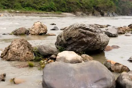
The flooding moved through river systems connected to Nepal’s Rasuwa and Nuwakot districts and the Gyirong border area in Tibet. According to Associated Press reporting published August 27, at least 273 people had been reported dead and more than 1,300 missing across the affected region at the time of its latest update.
Those numbers should be treated as a time-stamped snapshot, not a final total. Damaged roads, communications failures and the number of foreign visitors and pilgrims in the area have made it difficult for authorities to establish a complete list.
AP reported that Nepal’s Tourism Board counted hundreds of foreign nationals among the missing. Relief teams were also working to reach displaced residents, clear debris and restore access to isolated communities.
What may have triggered the flood?
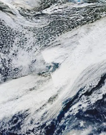
Early reports described the event as an earthquake. That interpretation changed as seismic and satellite evidence became available. The U.S. Geological Survey later classified the signal as a large glacier collapse rather than a conventional earthquake, according to the AP’s scientific explainer.
Researchers are examining whether falling ice and rock temporarily blocked a river before the accumulated water broke through and rushed downstream. That scenario remains a preliminary assessment. Scientists still need ground observations and additional satellite analysis to reconstruct the sequence accurately.
The International Centre for Integrated Mountain Development said water levels in the Bhote Koshi basin began rising rapidly at about 9 a.m. local time on August 26. ICIMOD researchers and partner institutions are investigating a possible ice-rock avalanche from a high-altitude area.
Why Himalayan glacier disasters can escalate so quickly
High mountain valleys can turn a distant collapse into a downstream emergency with very little warning. Ice, rock or landslide debris may dam water temporarily. If that unstable barrier fails, the released water can collect more sediment and boulders as it descends, increasing its destructive force.
Climate change is not a simple explanation for every individual disaster, and scientists avoid assigning a single event to warming before completing an attribution study. The broader risk, however, is well documented: warming temperatures can destabilize glaciers, thaw frozen slopes and expand glacial lakes. Communities, roads, hydropower facilities and border crossings are often concentrated in the valleys below.
Why the rescue videos went viral—and why verification matters
The most widely shared clips show fast-moving water surrounding homes and rescuers reaching people trapped above the flood. Their immediacy makes them powerful, but disaster footage is frequently reposted without its original date or location.
Before sharing a dramatic video, viewers can make three quick checks:
- Find the earliest upload. Reposts often remove the original caption and context.
- Compare landmarks. Bridges, road signs, mountain profiles and buildings can help confirm the reported location.
- Check a current official or established news source. Old flood footage is commonly recycled during new emergencies.
Unverified lists of missing people can also cause harm. Families should rely on official rescue agencies, embassies and recognized relief organizations rather than crowdsourced claims that lack contact details or timestamps.
What happens next?
Rescue work will gradually shift toward relief, shelter, medical care, clean water and reconnecting damaged transport routes. Investigators will also study the glacier collapse and the possibility of additional unstable blockages upstream.
The most useful way to follow the story is to watch for updates that clearly state when figures were verified and which authority supplied them. That discipline matters more than being first, especially while families are still waiting for news.
Sources and methodology: This explainer was independently written using time-stamped reporting from the Associated Press and a technical advisory from ICIMOD. Figures reflect information available on August 27, 2026 and may change as authorities reconcile reports.
Leon Ramoviq
Primary Author · Editorial Reviewer · Researcher Leon Ramoviq is a digital media researcher, content creator, and primary author at Smashology Media. His work focuses on researching, verifying, and developing stories across entertainment, culture, sports, internet trends, curiosity-driven topics, and viral news. Before publishing, Leon reviews sources, cross-checks key claims, and works to ensure that articles are clear, accurately represented, and based on reliable information rather than unverified social-media speculation. With experience in digital media, graphic design, social media content, and online audience engagement, he brings both an editorial and visual perspective to the stories published on Smashology. Leon is particularly interested in how stories spread online, why certain topics capture public attention, and how complex or trending information can be presented in a simple and engaging format. Role at Smashology As a primary author and researcher, Leon is involved in: • Researching stories and identifying original or reliable sources • Writing and developing articles for Smashology • Reviewing facts, names, dates, quotations, and contextual information • Checking stories for misleading or unsupported claims • Reviewing articles before publication • Following developments and updating stories when meaningful new information becomes available • Maintaining editorial consistency across Smashology content Editorial Approach Leon believes engaging content should not come at the expense of accuracy. His approach is to combine strong storytelling with responsible sourcing, clear attribution, and additional verification when a story originates from social media or rapidly developing online discussions.
Sources
Links cited in this article.